Research
Calibration/Validation
Verification of Level-2 products such as chlorophyll, suspended solids, and dissolved organic matter concentration
Calibration/Validation
Satellite image calibration and validation are a combination of verification/validation, which is a process of checking if the data given from a satellite meet a given quality standard, and calibration, which is a process of making data more precisely in comparison with the standard measured value.
The amount of light recorded through the optical sensor of a satellite is converted into an electronic value and saved in a satellite image. First, radiometric calibration that accurately specifies the relation between the light amount and the electronic value and geometric correction that corrects the location information of each pixel.
In addition, Level-1 products such as top-of-atmosphere radiance and Level-2 products such as remote sensing reflectance, chlorophyll, suspended solids, and dissolved organic matters are verified.
Calibration
- pre-launch satellite sensor calibration
- in-flight calibration
- lunar/star calibration
- vicarious calibration
- radiometric calibration
- geometric calibration
Validation
- Validation with field data
- Collection of field data through vessel
- Verification through a fixed observation point (Aeronet-OC, buoy)
- In comparison with other ocean satellites
- Comparison/Verification with polar-orbiting satellites such as MODIS and MERIS
- Accuracy/Uncertainty of remote sensing reflectance
- Performance verification of atmospheric correction
- Accuracy/Uncertainty of Level-2 products
- Verification and performance analysis of sea color algorithm
Management and improvement of image quality
- Correction of errors/bugs that occur in other ancillary data and preprocessing
- Quantification of deviation between slots and development of enhanced algorithms
Events and Services
Field survey by using offshore platform : Aeronet-OC
- This is an abbreviation of AErosol RObotic NETwork - Ocean Color.
- This unmanned system is installed in offshore platform such as offshore towers and ocean research stations to automatically measure the optical characteristics of aerosol and seawater reflectance.
- It manages the consistent calibration/validation and data processing of the observation system in cooperation with NASA.
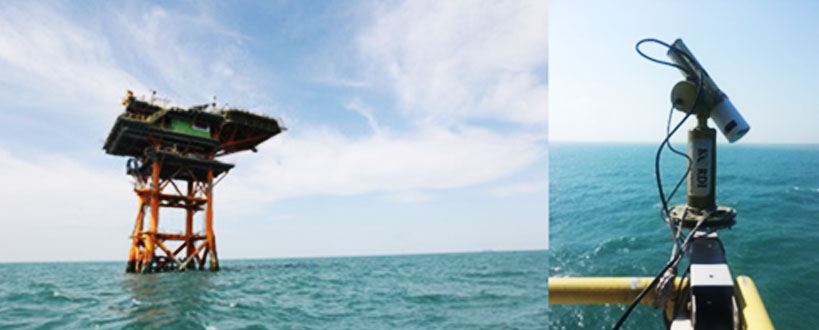
- Latitude: 32.12295° North
- Longitude: 125.18245° East
- Elevation: 29.0 Meters
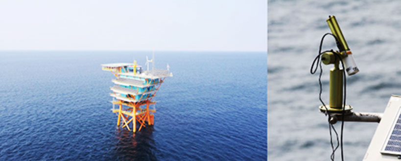
- Latitude: 37.42313° North
- Longitude: 124.73804° East
- Elevation: 28.0 Meters
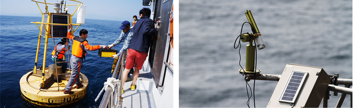
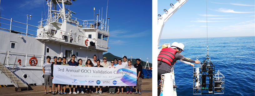
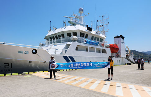
Field survey through vessels
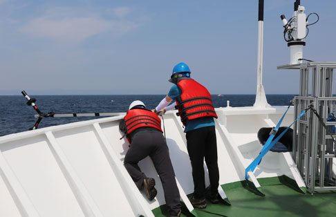
- Field survey through vessels: Field survey is conducted by using the research vessel owned by the KOIST to research the marine optical characteristics and marine environment in the seawater around the Korean Peninsula.
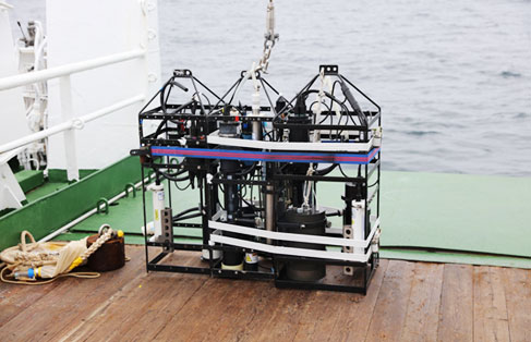
- The external optical characteristics and unique optical characteristics of the seawater are measured by using diverse types of portable spectrometers.
- In addition, water temperature, salinity, chlorophyll, and total suspended solids concentration are measured by using diverse types of marine observation equipment such as CTD for calibration/validation.
- Calculation and management of accurate field data through consistent research and sampling analysis methods
Reference papers for GOCI algorithm development/calibration/validations/enhancement by taking calibration/validation data
-
https://link.springer.com/article/10.1007/s12601-012-0027-1
