Data Analysis Tools
GOCI-ll ToolBoX(GTBX)
Extension plugin of the SNAP program to analyze and process data from GOCI-II
GOCI-ll ToolBoX(GTBX)
GTBX
(GOCI-ll ToolBoX)
(GOCI-ll ToolBoX)
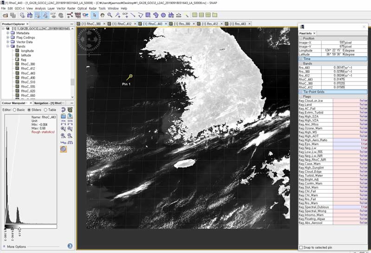
GTBX is an extension plugin of the SNAP program, developed by the European Space Agency (ESA), to analyze and process data from GOCI/GOCI-II.
SNAP is an open source common architecture, suitable for using earth observation data. Access the following link to check the details and download the program.
ESA SNAPRole of GTBX
- Display GOCI data (L1B/L2 HDF-EOS5 file)
- Display and analyze GOCI-II data (L1B/L2 NetCDF4 file)
- Search ad download desired data
- Search and download products with the condition of the tag, type, column, or attribute of products
- Select some dataset or an interested area of the products based on the Thredds Data Server (TDS) and download the data
- Process L2 products
- Process the real-time L2 products processing function of the terrestrial system of the Korea Ocean Satellite Center in SNAP offline in the same way
- Execute the Docker Container through the SNAP Graph Builder (the root authority is required)
GOCI-II Application
GTBX (GOCI-II Tool Box)
Sensor-specific Features
- Remote Data Access
- THREDDS
- OPeNDAP
- Internal Data Model / Visualization (L0 ~ L2, etc)
- Off-line L2 Generator
Data Processing & Analysis Platform
Visualization (Fast Image Display) GUI
- Fast Display
- Analysis
- Visualization
- GUI
- Operator interface Graph Builder
SNAP-Engine
Common Utilities Product IO Workflow CLI
- EO data model, I/O
- Generic I/O format (NetCDF, HDF, GeoTiff…)
- Projection
- Geo-coding
- Masking
- CLI
- Band Maths
- Image Filter
JVM
Runtime Platform (for Windows / Linux)
Main Functions of SNAP
- Common architecture for all toolboxes
- Display and explore gigapixel images very quickly
- Graph Processing Framework (GPF): For creating user defined processing chains
- Add and control new overlays like images from other bands or WMS or ESRI shapefiles through advanced layer management
- Define sufficient interested areas for statistics and various plots
- Define and overlay easy bitmask easily
- Flexibly calculate bands using an arbitrary equation
- Perform accurate re-projection and orthogonal correction for general map projections
- Perform geocoding and correction using ground reference points
- Automatically download SRTM DEM and select a tile
- Product library to efficiently scan and classify large archives
- Support multi-threading and multi-core processors
- Visualize the integrated WorldWind


