Ocean Observation Satellite
Overseas Ocean Satellite
Introducing overseas ocean satellites.
Overview of Overseas Ocean Satellites
The Korea Ocean Satellite Center has built X-band and L-band antennas since 1996 before Geostationary Ocean Color Imager (GOCI) was launched and directly received the data of overseas polar-orbiting satellites that observe the Earth.
The ocean color data among overseas satellite data are used to develop and calibrate/validate the algorithms of the GOCI, and the data other than ocean color data such as sea surface temperature are used for technology development.
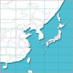
Reception Status and Area
- Receive overseas satellite data taken from the GOCI observation areas
| Satellite | Sensor | Products | Spatial Resolution | Operation |
|---|---|---|---|---|
| NOAA-18, 19 | AVHRR | Sea Surface Temperature | 1.1km | 2011.09 ~ |
| EOS AM-1 (Terra), EOS PM-1 (Aqua) | MODIS | Sea surface temperature, seawater environment | 1km | 2011.09 ~ |
| NPP | VIIRS | Sea surface temperature, seawater environment, nighttime light | 750m | 2016.06 ~ |
| JPSS-1 | VIIRS | Sea surface temperature, seawater environment, nighttime light | 750m | Coming soon... |
About sensors
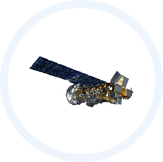
In case of AVHRR, starting from TIROS-N in 1978, NOAA-6, NOAA-7, and NOAA-8 were launched in Jun. 27, 1979, Jun. 1981, and 1983,
respectively. Currently, NOAA-18 and NOAA-19 are being operated. These satellites have visible light, near-infrared ray,
and infrared light sensors to observe the Earth and monitor environments.
Go
| Band | Wavelength (μm) | Resolution (km) | Main Purpose |
|---|---|---|---|
| 1 | 0.58 ~ 0.68 | 1.1 | Ground surface such as lower clouds and fog |
| 2 | 0.73 ~ 1.10 | Vegetation, coastline | |
| 3 | 3.55 ~ 3.93 | Sea surface temperature, lower clouds | |
| 4 | 10.5 ~ 11.5 | Cloud temperature, sea surface temperature | |
| 5 | 11.5 ~ 12.5 | Cloud temperature, sea surface temperature |
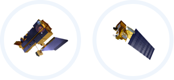
MODIS is the main sensor of EOS that provides data based on the dynamics of the biosphere of the Earth.
It is a multi-purpose sensor that can be applied to sea, land, and atmosphere. This sensor was first built in the Terra in Aug.
1999 and additionally built in the Aqua in May 2002.
Go
| Band | Wavelength (μm) | Main Purpose | Resolution (m) |
|---|---|---|---|
| 1 | 620 ~ 670 | Boundary of Land/Cloud | 250 |
| 2 | 841 ~ 876 | ||
| 3 | 459 ~ 479 | Features of Land/Cloud | 500 |
| 4 | 545 ~ 565 | ||
| 5 | 1230 ~ 1250 | ||
| 6 | 1628 ~ 1652 | ||
| 7 | 2105 ~ 2155 | ||
| 8 | 405 ~ 420 | Ocean Color/Phytoplankton/Biogeochemistry | 1000 |
| 9 | 438 ~ 448 | ||
| 10 | 483 ~ 493 | ||
| 11 | 526 ~ 536 | Ocean Color/Phytoplankton/Biogeochemistry | |
| 12 | 546 ~ 556 | ||
| 13 | 662 ~ 672 | ||
| 14 | 673 ~ 683 | ||
| 15 | 743 ~ 753 | ||
| 16 | 862 ~ 877 | ||
| 17 | 890 ~ 920 | Atmospheric Water Vapor | |
| 18 | 931 ~ 820 | ||
| 19 | 915 ~ 965 | ||
| 20 | 3.660 ~ 3.840 | Surface/Cloud Temperature | |
| 21 | 3.929 ~ 3.989 | ||
| 22 | 3.929 ~ 3.989 | ||
| 23 | 4.020 ~ 4.080 | ||
| 24 | 4.433 ~ 4.49 | Air Temperature | |
| 25 | 4.482 ~ 4.549 | ||
| 26 | 1.360 ~ 1.390 | Cirrus Vapor | |
| 27 | 6.535 ~ 6.895 | ||
| 28 | 7.175 ~ 7.475 | ||
| 29 | 8.400 ~ 8.700 | ||
| 30 | 9.580 ~ 9.880 | Ozone | |
| 31 | 10.780 ~ 11.280 | Surface/Cloud Temperature | |
| 32 | 11.770 ~ 12.270 | ||
| 33 | 13.185 ~ 13.485 | Cloud Altitude | |
| 34 | 13.485 ~ 13.785 | ||
| 35 | 13.785 ~ 14.085 | ||
| 36 | 14.085 ~ 14.385 |
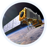
VIIRS was built in NPP and JPSS-1 on Oct. 28, 2011.
This Earth observation satellite of NASA is for ocean observation among the five sensors of NPP.
VIIRS was developed to take over the roles of MODIS and AVHRR, which have been operated for years.
Go
| Band | Wavelength (μm) | Main Purpose | Resolution (m) |
|---|---|---|---|
| M1 | 0.402 ~ 0.422 | Aerosol | 750 |
| M2 | 0.436 ~ 0.454 | ||
| M3 | 0.478 ~ 0.498 | ||
| M4 | 0.545 ~ 0.565 | ||
| M5 | 0.662 ~ 0.682 | ||
| M6 | 0.739 ~ 0.754 | Atmospheric Correction | |
| M7 | 0.846 ~ 0.885 | Aerosol | |
| M8 | 1.230 ~ 1.250 | Cloud Particle Size | |
| M9 | 1.371 ~ 1.386 | Cirrus, Cloud | |
| M10 | 1.580 ~ 1.640 | Snow | |
| M11 | 2.230 ~ 2.280 | Cloud | |
| M12 | 3.610 ~ 3.790 | Surface Sea Temperature | |
| M13 | 3.970 ~ 4.130 | Surface Sea Temperature, Forest Fire | |
| M14 | 8.4 ~ 8.7 | Surface Sea Temperature | |
| M15 | 10.26 ~ 11.26 | ||
| M16 | 11.54 ~ 12.49 | ||
| DNB | 0.5 ~ 0.9 | Nighttime Light | |
| I1 | 0.6 ~ 0.68 | Vegetation | 350 |
| I2 | 0.85 ~ 0.88 | ||
| I3 | 1.58 ~ 1.64 | Snow, Ice Index | |
| I4 | 3.55 ~ 3.93 | Cloud | |
| I5 | 10.5 ~ 12.4 | Cloud |