Ocean Observation Satellite
GOCI -Ⅱ
Introducing the Geostationary Ocean Color Imager -Ⅱ
GOCI -Ⅱ
GOCI -Ⅱ, Geostationary Ocean Color Imager -Ⅱ
The GOCI-II, a maritime sensor of GK-2B, which is a geostationary satellite (Geo-Kompsat-2B), takes over the role of GOCI and observes the entire sectors including Northeast Asia.
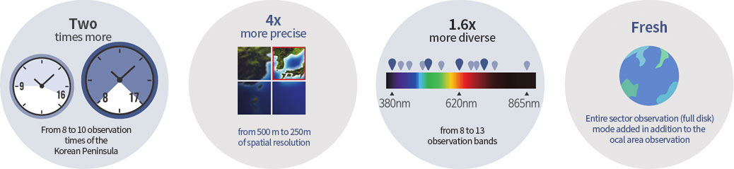
In comparison with GOCI, the GOCI -Ⅱ is available for better spatial and temporal resolution, observation area, and optical performance, etc. and gives 26 types of products rather than 13 ones.
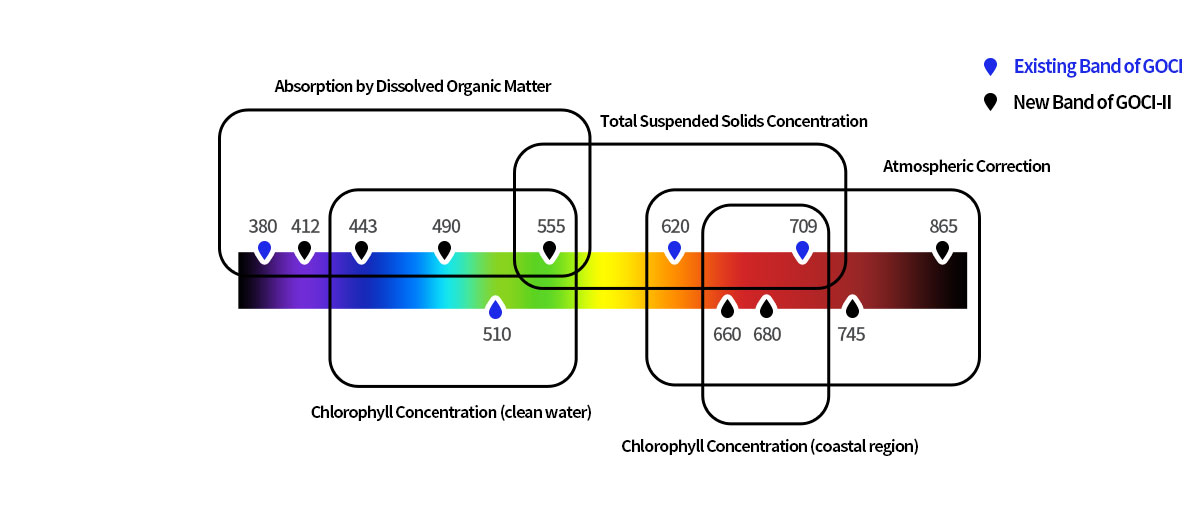
Points of GOCI-ll, better than GOCI
Specification
| Item | Geostationary Ocean Color Imager-II (GOCI-II) |
|---|---|
| Development/Operation | This satellite was developed by the Korea Aerospace Research Institute and AIRBUS, a French company, and has mainly operated by both the Korea Ocean Satellite Center of the Korea Institute of Ocean Science & Technology and the National Ocean Satellite Center of the Korea Hydrographic and Oceanographic Agency |
| Launching Date | 19. Feb. 2020 |
| Orbit | Altitude 35,786 km, 128.2ºE |
| Performance Period |
Feb. 2020 ─ Sep. 2020 (initial test operation) Oct. 2020 ─ Sep. 2030 (10 years for regular mission) |
| Spatial Resolution | 250 m (regional observation) / 1 km (entire sector observation) |
| Temporal Resolution | 1 hour for regional observation (10 times/day, 23 UTC ─ 8 UTC); daily for the entire sector observation |
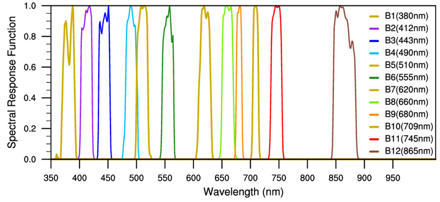
| Band | 13 bands (1 band for UV, 8 bands for visible light, 3 bands for near-infrared ray, 1 band for broad bandwidth) |
| Spectral Range | 370 ~ 865nm |
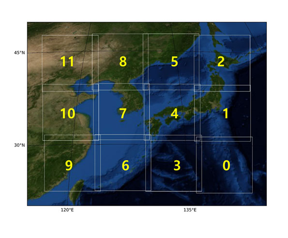
| Imaging Area | Regional 2,500 km X 2,500 km (Center coordinate 130°E, 36°N) |
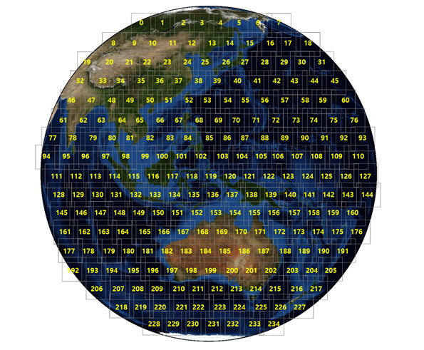
| Imaging Slot | Regional 12 slots (1 slot 2,780 X 2,780 pixels) / Entire sector 235 slots |
| Products |
26 types (Remote sensing reflectance, chlorophyll concentration, total suspended solids concentration, absorption by dissolved organic matter, diffuse attenuation coefficient for downward irradiance, Secchi depth, marine primary productivity, red tide, surface layer current, aerosol optical depth, aerosol type (yellow sand), terrestrial vegetation index, enhanced vegetation index, atmospheric component column correction reflectance, extinction coefficient, backscattering coefficient, sea fog, floating algae, low salinity water, sea ice, fishery environmental index, oceanic front, land surface reflectance, land albedo, land normalized reflectance, and land cover) |
Slot Image Order
[Regional Observation Area]
[Entire Sector Observation Area]
Spectral response function
(49111) Korea Ocean Satellite Center of the Korea Institute of Ocean Science & Technology, 385, Haeyang-ro, Yeongdo-gu, Busan, Republic of Korea
Copyright Korea Ocean Satellite Center. All Rights Reserved.