Ocean Observation Satellite
GOCI
Introducing the Geostationary Ocean Color Imager
GOCI
GOCI, Geostationary Ocean Color Imager
GOCI is an oceanic payload among the three observers of the Communication, Ocean and Meteorological (COMS), the world's first geostationary orbit satellite.
The Korea Ocean Satellite Center of the Korea Institute of Ocean Science & Technology, which is a major organization of GOCI, provides marine environment information in real time by using the GOCI data.
Specification
| Item | Geostationary Ocean Color Imager (GOCI) |
|---|---|
| Development/Operation | This satellite was developed by the Korea Aerospace Research Institute and the ASTRIUM (present AIRBUS), a French company, and mainly operated by the Korea Ocean Satellite Center of the Korea Institute of Ocean Science & Technology |
| Launching Date | 2010-06-27 |
| Orbit | Altitude 35,786 km, 128.2ºE |
| Performance Period |
Aug. 2010 ─ Mar. 2011 (initial test operation) Apr. 2011 ─ Mar. 2018 (7 years for regular mission) 1st extension: Apr. 2018 ─ Mar. 2020 2nd extension: Apr. 2020 ─ Mar. 2021 |
| Spatial Resolution | 500m |
| Temporal Resolution | 1 hour (8 times/day, 0 UTC ─ 7 UTC) |
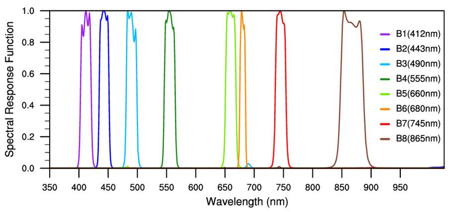
| Band | 8 bands (6 bands for visible light, 2 bands for near-infrared ray) |
| Spectral Range | 412 ~ 865nm |
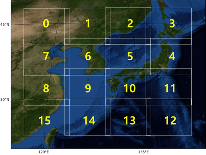
| Imaging Area | Regional 2,500 km X 2,500 km (Center coordinate 130°E, 36°N) |
| Imaging Slot | 16 slots (Total 5,685 X 5,567 Pixels) |
| Products |
13 types (Remote sensing reflectance, chlorophyll concentration, total suspended solids concentration, absorption by dissolved organic matter, diffuse attenuation coefficient for downward irradiance, Secchi depth, marine primary productivity, red tide, surface layer current, aerosol optical depth, aerosol type (yellow sand), terrestrial vegetation index, and enhanced vegetation index) |

Slot Image Order
Spectral response function
(49111) Korea Ocean Satellite Center of the Korea Institute of Ocean Science & Technology, 385, Haeyang-ro, Yeongdo-gu, Busan, Republic of Korea
Copyright Korea Ocean Satellite Center. All Rights Reserved.